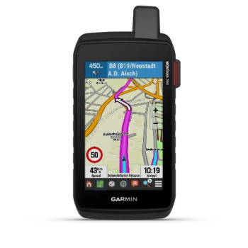
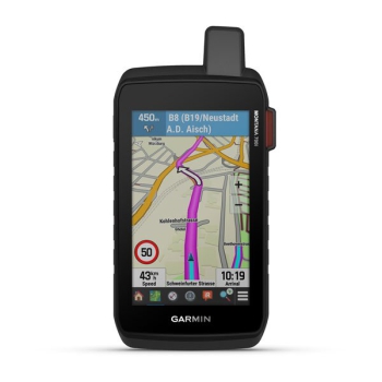
-11%

Garmin Montana 700i

  • Code: 010-02347-11
€ 666,50 € 750,00 -11%

Montana® 700i

Rugged touchscreen GPS navigator featuring inReach® technology

LIVE YOUR ADVENTURE WITH A SATELLITE CONNECTION

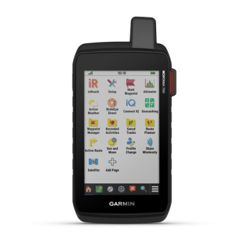
To keep adventurers in touch and on the right path, the Montana 700i handheld device combines the best on-road and off-road navigation with two-way messages and interactive SOS via inReach 1 satellite technology


Big news. The QWERTY keyboard allows you to type messages easily.

Extend your routes but stay connected with inReach for messages and SOS 24/7.

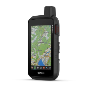
Preloaded TopoActive Europe maps. You are now free to choose road or off-road routes.

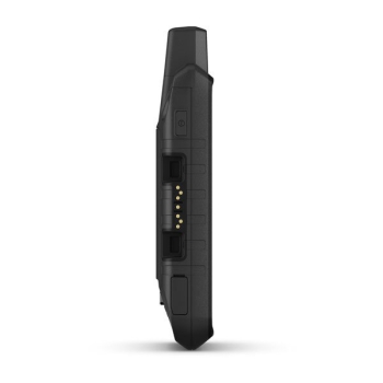
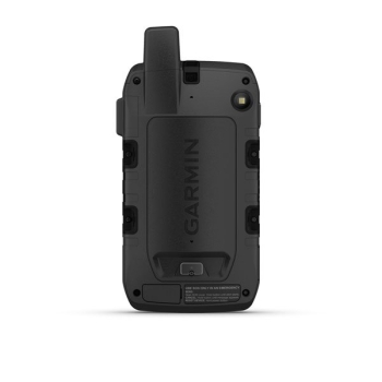
Compliant with MIL-STD 810 standard to withstand extreme temperatures, shocks, water and vibrations.

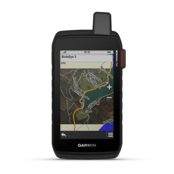
BirdsEye satellite imagery downloadable directly to your device.

Live your adventures thanks to the lithium-ion battery with a duration of over 18 in GPS mode.


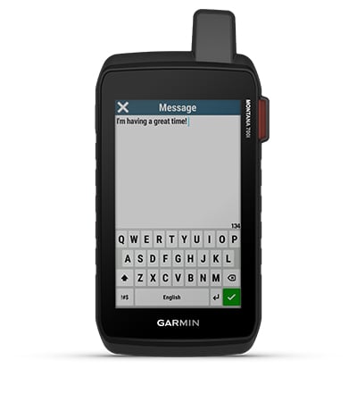
BIDIRECTIONAL MESSAGE

Exchange text messages with your friends / family, post on social media or communicate from one inReach device to another (satellite subscription required).
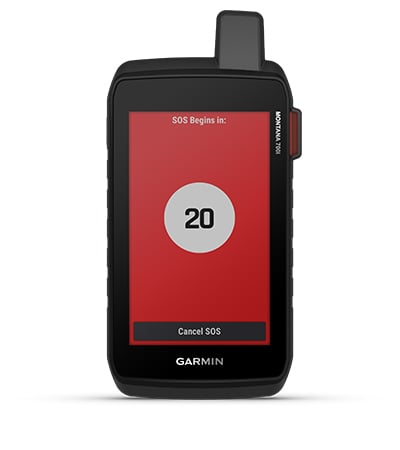
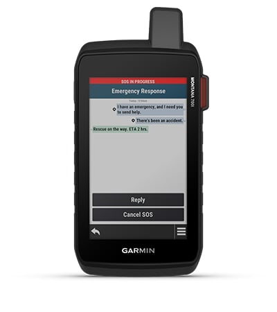


INTERACTIVE SOS

In the event of an emergency, press and send an interactive SOS to GEOS, the international rescue and monitoring center, operating 24/7 (satellite subscription required).


IRIDIUM GLOBAL SATELLITE NETWORK

Instead of relying solely on smartphone coverage, your messages, SOS requests and tracking are transmitted via the Iridium ® global satellite network (active satellite subscription required).


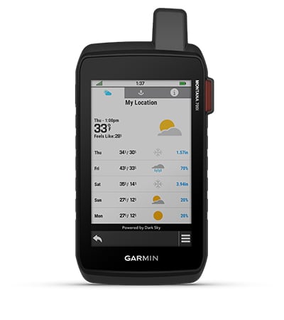
INREACH WEATHER FORECAST SERVICE

The optional inReach weather forecast service provides detailed updates directly to your Montana mobile device or a paired device to let you know in advance what the weather will be on your route.
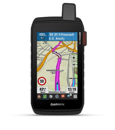


CITY NAVIGATOR MAPS

Seamlessly switch between routes and on-road navigation with preloaded City Navigator street maps, which guide you through simple turn-by-turn directions with pronounced street names.


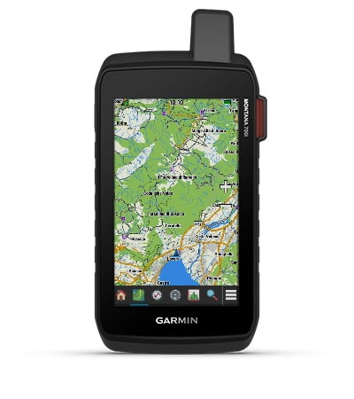
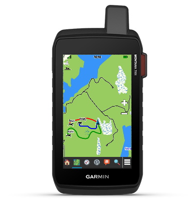
TOPOACTIVE EUROPE MAPS

For your adventures, use the preloaded TopoActive Europe maps. View elevations, coasts, rivers, and more
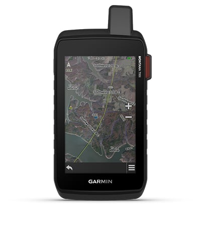


BIRDSEYE IMAGES

Direct download of BirdsEye satellite imagery to your device (no annual subscription required) allows you to view photorealistic views and create waypoints based on landmarks.
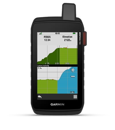


ABC SENSORS

Walk your next path with ABC sensors; includes an altimeter for elevation data, a barometer to monitor the weather and a 3-axis electronic compass.
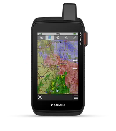


WEATHER FORECAST

Cellular Connection 2 allows you to access updated weather forecasts via the Garmin Connect ™ app.


TRACKING CINOFILO

For hunters and trainers, Montana allows you to synchronize with portable Astro ® or Alpha ® series devices (sold separately) to track and track dogs.


MULTI-GNSS RECEPTION

Access to the GPS, GLONASS and GALILEO satellite networks allows Montana ® 700i to acquire location in more remote areas than using GPS alone.

TRACKING

Track your location and share it with whoever is at home or in the field. This way, you can allow others to view your progress or send your GPS location and more via the MapShare ™ web page (Montana 700i, 750i only, satellite subscription required).

EXPEDITION MODE

Use Expedition Mode to extend Montana's battery life for a week or more. With this mode, the screen turns off, the device goes into energy saving mode but continues to collect, albeit in a reduced number, the GPS track points.

EXTENDED BATTERY LIFE

The internal rechargeable lithium-ion battery offers more than 18 hours of life in GPS mode.

COMPATIBLE SUPPORTS

A wide range of Montana portable device compatible brackets (sold separately) allow you to adapt the navigator for use on motorcycles, ATVs, boats, automobiles, RVs or other vehicles.

TECHNICAL FEATURES

Montana ® 700i / 750i battery type

Li-ion rechargeable battery

Montana 700

Rechargeable lithium-ion battery or three AA batteries (NiMH, alkaline or lithium). Lithium batteries are recommended.

NOTE: The AA battery adapter is not included.

Battery life

Up to 18 hours in GPS mode

Up to 2 weeks in expedition mode

Water resistance classification

IEC 60529 IPX7 1

Operating temperature range

-20 ° to 60 ° C (-4 ° to 140 ° F)

Charging temperature range

0 ° to 45 ° C (32 ° to 113 ° F)

Safe distance from the compass

60 mm (2.36 in.)

Wireless frequencies

2.4 GHz @ 16.91 dBm nominal

1.6 GHz @ 31.7 dBm nominal

D. Buonasera, ho bisogno di un paio di info relativamente al gps garmin montana 700i: 1) utilizza la rete GLONASS? 2) puó utilizzare batterie AA in caso di emergenza? Grazie mille Monica
R. 22-04-23 Buongiorno, riporto le indicazioni dal manuale per il punto 1: Il dispositivo in uso è in grado di utilizzare questi sistemi satellitari di navigazione globale. Alcuni sistemi satellitari non sono disponibili in tutti i modelli di dispositivo. GPS: una costellazione di satelliti realizzata dagli Stati Uniti. GLONASS: una costellazione di satelliti realizzata dalla Russia. GALILEO: una costellazione di satelliti realizzata dall'Agenzia spaziale europea. Per il punto 2, purtroppo non compatibile con il package batterie AA. Cordiali saluti. Luigi Bianchi
D. Nuovo? Ricondizionato? Con garanzia Garmin? Grazie
R. 06-09-2021 Buonasera, si tratta di oggetto assolutamente nuovo con garanzia due anni Garmin Italia. Cordiali saluti. Luigi Bianchi
D. Buongiorno, Volevo chiedere se il prodotto Garmin 700i sarà possibile averlo disponibile per l'acquisto? Se si in che tempistiche si potrà contare per riaverlo disponibile?
R. 27-06-2021 Buonasera, non ho ancora delle tempistiche certe da Garmin, probabilmente fra ca 7/10 GIORNI. Cordiali saluti. Luigi Bianchi
D. Buonasera per uso nautico non riesco a capire se il Montana700i e il Gpsmap 86i sono analoghi, le descrizioni non sono agevolmente comparabili, mi sembra di capire che il Montana ha le mappe stradali mentre l'86i quelle nautiche e ha lo slot per leggere le carte BlueChart. Sarei orientato per l'acquisto dell'86i ma il Montana ha lo schermo più grande e la tastiera qwerty in sovraimpressione e mi sembra più comodo. Cosa mi consiglia considerando che lo userò prevalentemente nella nautica? grazie Sergio
R. 16-05-2021 Buongiorno, confermo la compatibilità di tutti i Montana con cartografie nautiche G3. Onestamente fra i due sceglierei Montana.... Attenti però all'acqua salata. Cordialmente. Luigi Bianchi
D. Avevo due domande da porre.. 1. Con abbonamento satellitare è quindi possibile usufruire dei servizi in reach senza acquistare altro apparecchio 2. Dove posso effettuare abbonamento satellitare e come collegarlo al mio navigatore? Grazie.
R. 01-05-2021 Buonasera, certo, confermo, già incluso delle funzionalità inReach. invio di seguito link diretto al sito Garmin: https://discover.garmin.com/it-IT/inreach/personal/#subscriptions Cordiali saluti. Luigi Bianchi
D. buon giorno io devo installare il navigatore montana 700I su una mota da enduro ( ktm exc-f 250 anno 2020) voi vendete anche la staffa ?
R. 27-02-2021 Buonasera, certamente sì, eccola: https://www.painestore.it/garmin_supporto_manubrio_montana_700 Cordiali saluti. Luigi Bianchi
D. Sul Montana 700 posso visualizzare anche una cartografia nautica, in particolare Navionics?
R. 30-01-2021 Buonasera, sì, può abbinare anche Mappe Nautiche, però solo Garmin non Navionics: https://www.painestore.it/cartografia_garmin Cordiali saluti. Luigi Bianchi
Products that may be of interest to you
  • Advise
  • Advise

    We answer your questions by always recommending the most suitable equipment.

  • Design
  • Design

    We design the on-board electronics from the single-line diagram, facilitating your installation.

  • Execute
  • Execute

    We build systems with high quality components, cables and accessories.

  • Assist
  • Assist

    We guarantee an after-sales service for all items in our catalog

Don't lose your way!
Subscribe to our free newsletter.
  • Scalapay
  • Paypal
  • Contrassegno
  • Visa
  • Mastercard
  • Bonifico
  • Santander