Garmin GPSMAP 86i inReach
The new portable dedicated to the marine world with integrated inReach® technology
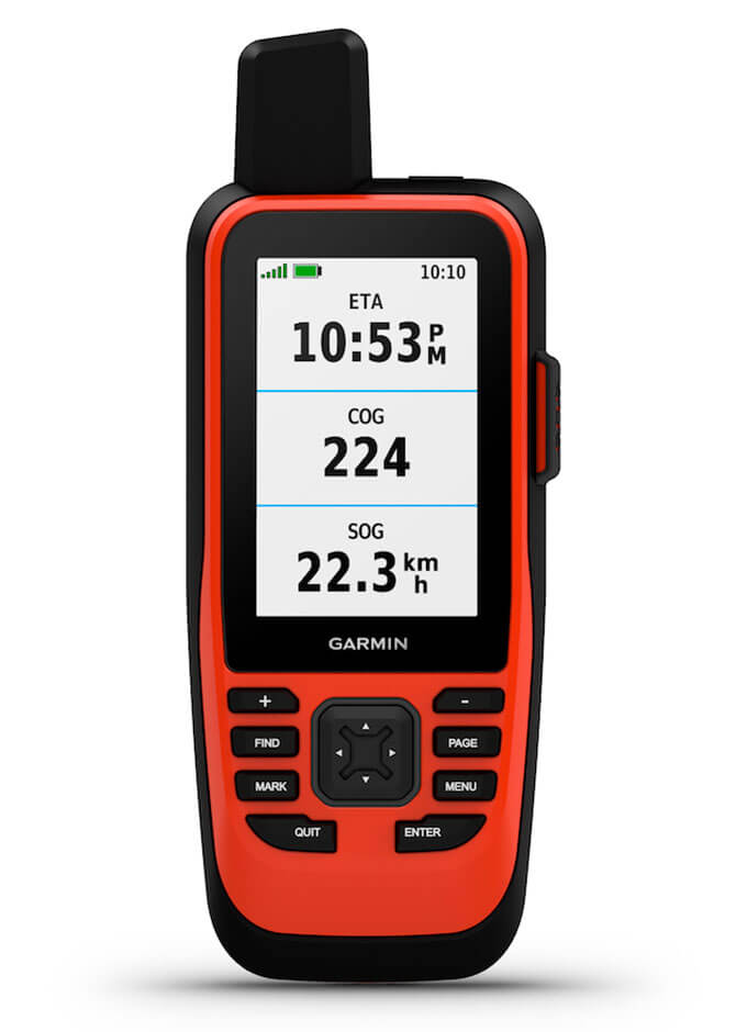
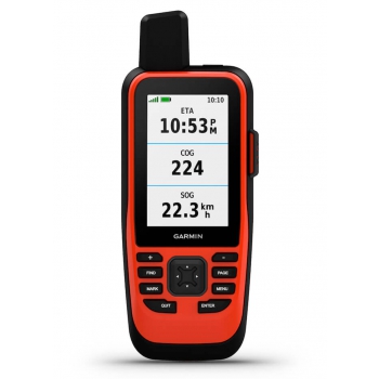
Water resistant, it is equipped with a bright 3 ”color display perfectly legible in any light conditions
Boat data streaming from chartplotter and compatible tools to consolidate information from your onboard instrumentation
The GPSMAP® 86i version also includes InReach ® technology which guarantees, through the Iridium ® global satellite network, the sharing of one's position, two-way messaging (to and from) any mobile device and an emergency service active 24 hours a day. to request help even where there is no cellular coverage. (satellite subscription required)
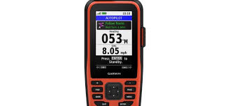
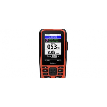
The innovative GPSMAP® 86, allow an exclusive control of the autopilot, a management of
FUSION® multimedia systems and even the consultation of all data useful for navigation
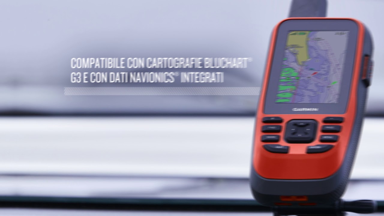
Supports BlueChart® g3 charts
The adjustable GPS filter makes speed and direction indications more uniform in rough seas
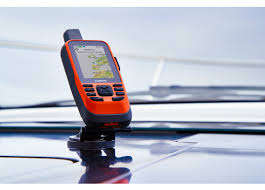
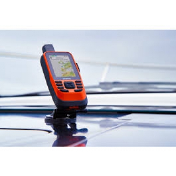
Navigate in total safety thanks to the new GPSMAP® 86i series of floating handhelds. On a fishing trip, a sailing trip or a cruise, you will leave the moorings in complete tranquility thanks to a backup navigator with satellite communication and interactive SOS. This advanced feature handheld device floats and features a 3 "color and anti-glare screen. It also features wireless connectivity that allows you to have a virtual extension of compatible Garmin navigation systems installed on board in the palm of your hand.
Connect to your boat 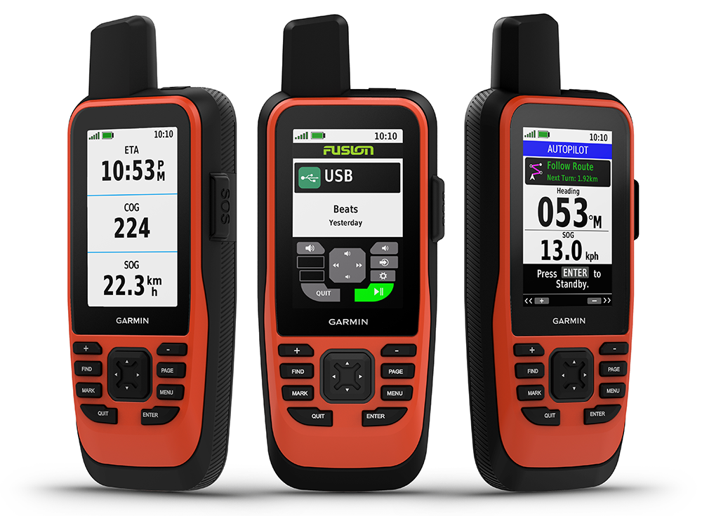
Synchronizes the GPSMAP® 86i with compatible Garmin chartplotters and instruments to view real-time vessel data on your handheld device. The innovative GPSMAP® 86 allows exclusive control of the autopilot, management of the FUSION® multimedia systems and even the consultation of all data useful for navigation.
Satellite communication
Integrated inReach satellite technology and additional assistance options1 of the new GPSMAP® 86i. guarantee, through the Iridium ® global satellite network, the sharing of one's position, two-way messaging (to and from) any mobile device and an emergency service active 24 hours a day to request help even where there is no cellular coverage.
BlueChart g3 cartography
GPSMAP® 86i comes preloaded with a worldwide basemap. It also allows you to add BlueChart g3 coastal charts, which provide industry-leading coverage, clarity and detail thanks to integrated data from Garmin and Navionics®. Detailed depth lines display 0.3 meter bathymetry, providing a more precise description of the bottom structure to create optimized fishing maps and increase the level of detail at marshes, canals and port facilities.
Stay connected
Receive smart notifications directly on the GPSMAP® 86i handheld device after pairing it with your compatible smartphone. You can also synchronize the GPSMAP® 86i with the Garmin Explore ™ portal app for cloud management of your favorite waypoints, tracks and routes. GPSMAP® 86i offers Wi-Fi® connectivity, ANT + ® technology and Bluetooth® wireless technology for easy wireless updates and connections. For long journeys, the internal, rechargeable lithium battery offers up to 35 range in detection mode every 10 minutes2.
Packaging:
GPSMAP® 86i handheld device with worldwide basemap
Drawstring
USB to Micro USB cable
Documentation