Garmin eTrex Touch
ADVENTURE WITH A TOUCH
Portable touchscreen GPS, essential and easy to use. It offers preloaded TopoActive maps with routes and routable roads for your outdoor adventures. Plus, the durable design and long-lasting battery let you enjoy your passions even longer.
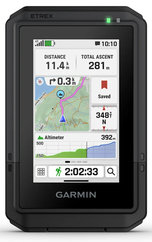
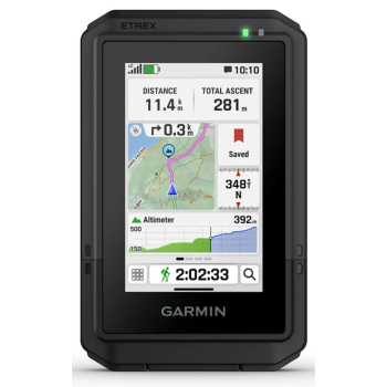
 SCROLL AND ZOOM ON A BRIGHT 3" TOUCHSCREEN
 PRELOADED MAPS FOR ROADS AND TRAILS
 UP TO 130 HOURS OF BATTERY LIFE IN GPS MODE
 PLAN AND TRIP REVIEW WITH THE GARMIN EXPLORE SMARTPHONE APP
 RUGGED CONSTRUCTION (MIL-STD 810) AND WEATHER RESISTANT (IP67)
 OPTION TO PURCHASE AN OUTDOOR MAPS+ PLAN FOR PREMIUM MAPS
WHAT YOU WILL LIKE
TOUCH SCREEN
Slim, pocket-sized portable GPS with a bright, high-resolution 3" color touchscreen for scrolling and zooming your route.
RESISTANT IN ANY CONDITION
The portable eTrex Touch is purpose-built with an IP67 waterproof rating and designed to withstand shock (MIL-STD-810) and the harshest weather conditions.
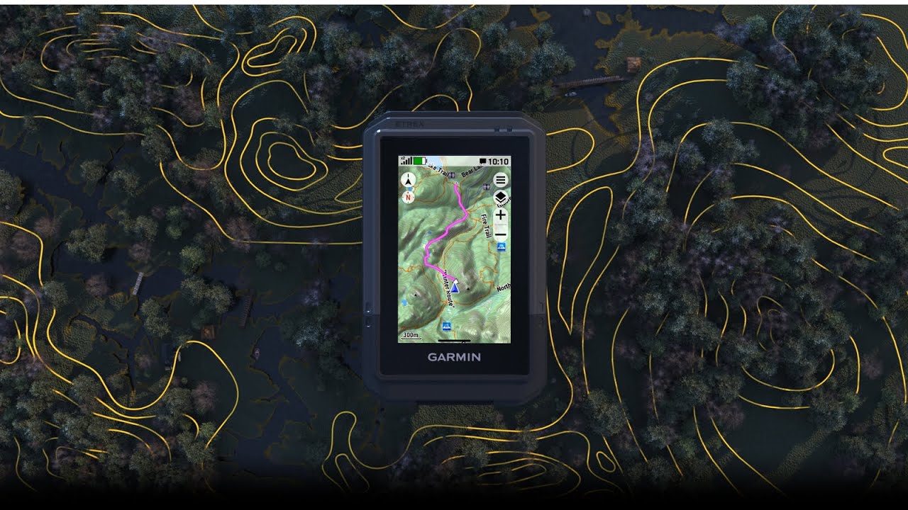
PRELOADED MAPS
View detailed TopoActive maps for roads and trails, see terrain contours, elevations, peaks, parks, rivers, lakes, and geographic landmarks, along with thousands of other points of interest. Plus, you can easily access additional TopoActive maps from around the world.
OUTDOOR MAPS+
Purchase an Outdoor Maps+ subscription for continuous access to a wide range of premium mapping content, including satellite imagery, campsites, and more. Download and receive automatic updates via Wi-Fi.
PLAN AND ANALYZE YOUR TRIP
Connect with Garmin Explore to plan and analyze trip data on your smartphone or tablet and manage waypoints, routes and activities.
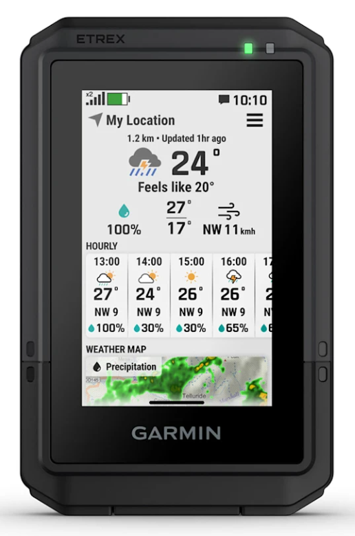
WEATHER FORECAST
Get real-time forecast information to stay informed about changing conditions. This feature requires an active internet or Wi-Fi connection, or the Garmin Explore app on your paired smartphone.
MORE OUTDOOR FUN. AT YOUR FINGERTIPS.
EXPLORATION FUNCTIONS
BATTERY LIFE
You can count on a battery life of up to 130 hours with all satellite systems active plus multiband mode (assuming typical use with SatIQ technology) and up to 650 hours in Expedition mode.
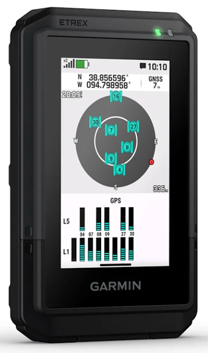
 GPS ACCURACY
Know your location with multi-band GPS and multi-GNSS support, which gives you access to multiple frequencies sent by navigation satellites for greater location accuracy.
 FIND NEW DESTINATIONS
Popularity-based routing helps you navigate the best routes. Round-trip routing lets you enter a desired distance and receive route suggestions that will bring you back to where you started.
 CLIMB PLANNING
Find out about upcoming climbs along the route, when they will occur, and how steep they will be.
 DIGITAL COMPASS
Follow the detected direction with the digital compass, which provides precise directions even when stationary or without GPS reception.
 GEOCACHING
Get cache updates from Geocaching Live, including descriptions, logs, and hints. Once connected to the Garmin Explore app on your compatible smartphone, each find is uploaded to your geocaching.com profile.
 GARMIN SHARING
Easily share saved locations and routes with your friends' compatible Garmin devices.
 ALONG THE JOURNEY
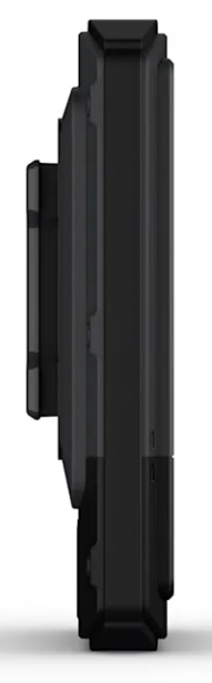
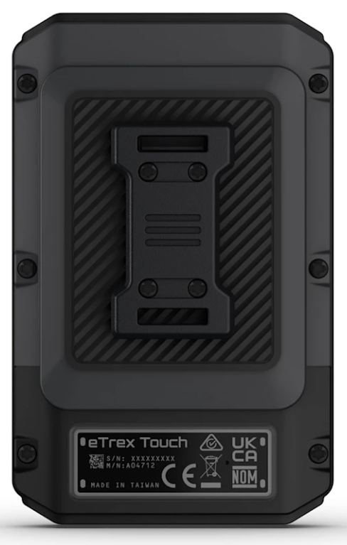
The device features a built-in Spine Mount 2 and is compatible with additional accessories sold separately.