THE BEST STARTS HERE
It's the 4K touchscreen chartplotter for boaters and fishing enthusiasts who want the best on board. Enjoy the beauty of an edge-to-edge display and the luxury of a glass dashboard with high-quality design and materials.

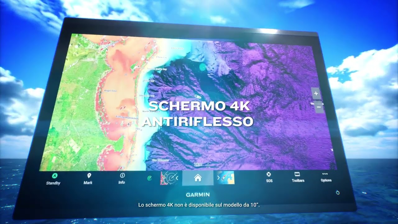
HIGH-QUALITY 4K IPS TOUCHSCREEN DISPLAY THAT IS SUNLIGHT-READABLE FROM ANY ANGLE

PROCESSING POWER UP TO 7 TIMES FASTER THAN PREVIOUS GENERATIONS

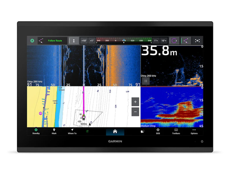
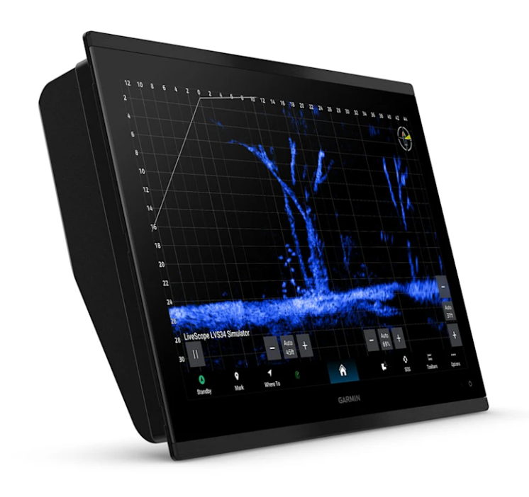
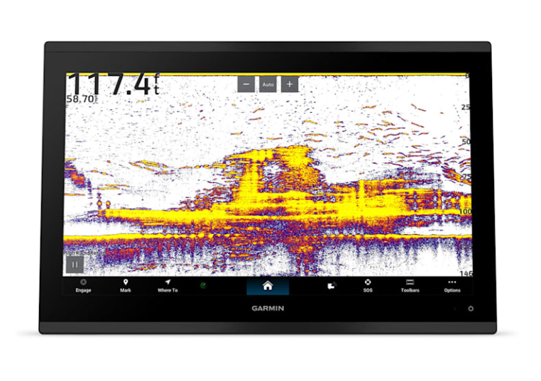
SEE MARKINGS LIKE NEVER BEFORE WITH OUR BEST FISHFINDER EVER

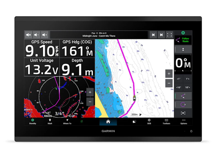
SUPPORTS GARMIN NAVIONICS+ CHARTS WITH AUTO GUIDANCE+ TECHNOLOGY

GIGABIT SPEED ON THE GARMIN BLUENET NETWORK

INTEGRATE WITH VARIOUS CHARTPLOTTERS, CAMERAS AND MORE
WHAT YOU WILL LIKE
HIGH QUALITY CHARTPLOTTER
The 4K IPS touchscreen display, perfectly readable under direct sunlight, and the edge-to-edge design offer a modern and elegant look.
EVEN FASTER
Processing power is 7x faster than previous generations for superior performance; quickly see chart detail and automatically calculate routes with Auto Guidance+ technology with a Garmin Navionics+ subscription.
HIGH DEFINITION FISHFINDER
Fish with incredible definition thanks to built-in 1kW xCHIRP technology and RapidReturn sonar. Excellent target separation lets you see fish markings clearly and in detail.
GARMIN BLUENET NETWORK
Create connected ecosystems with multiple chartplotters, cameras, radar and fishfinders, and take advantage of gigabit-speed network connectivity.
PERSONALIZED ENTERTAINMENT
Discover audio and video integrations that let you play and listen to the same video on all the screens and speakers on your network.
TOTAL CONNECTION
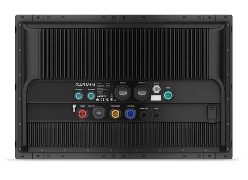
Take command by integrating digital systems to monitor, automate, and control your vessel. The chartplotter uses NMEA 2000 networking to connect with other compatible instruments.
LUXURY ON YOUR DASHBOARD
CONNECT
 Software updates
Get wireless software updates through the ActiveCaptain app with a compatible smartphone or tablet.
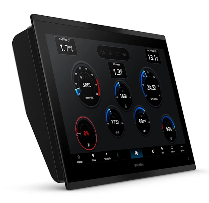
 ENGINE MONITORING
Keep an eye on your engine performance.
 CUSTOM LOOK
Builders can customize the homepage layout and startup image for maximum customization.
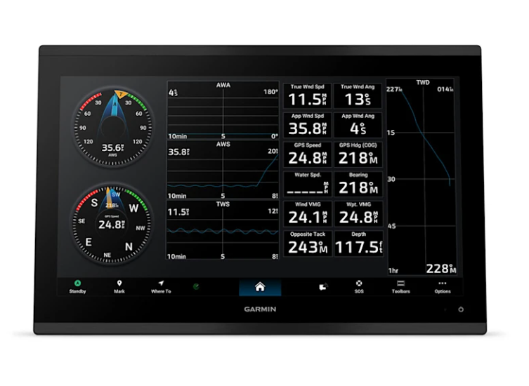
NAVIGATION
CARTOGRAPHY
Navigate with optional Garmin Navionics+ charts that include Auto Guidance+ technology, daily updates and more (subscription required).
 RELIABLE PREMIUM CARDS
Support for Garmin Navionics Vision+ charts with Relief Shading and high-quality satellite imagery.
 ALWAYS MONITOR YOUR LOCATION
Find your precise location with built-in 10Hz dual-frequency GPS.
 AUTOPILOT
Control the autopilot with any compatible chartplotter on the network with autopilot integration.
INTEGRATION
 CONNECT THE CAMERAS
Full camera support and control to view footage directly on the chartplotter.
 CONTROL VIA QUATIX
Connect to your chartplotter with your compatible Garmin smartwatch.
 Wireless connectivity
Allows you to connect compatible devices using Bluetooth technology or ANT.
 VOICE COMMANDS
Use voice commands to control your chartplotter using a compatible headset or quatix smartwatch.
 RESISTANT TO THE MARINE ENVIRONMENT
The GPSMAP 9000xsv chartplotter is designed specifically for marine use with an IPX7 water rating.