DISCOVER A NEW DIMENSION
Featuring a sleek aesthetic in an ultrawide, edge-to-edge glass format, this new 15-inch chartplotter delivers a panoramic experience at the helm. It’s 74% wider and boasts more pixels than a standard 9-inch chartplotter while maintaining the same vertical footprint, for greater visual clarity and an unparalleled onboard experience.

THE 15-INCH ULTRAWIDE IPS (IN-PLANE SWITCHING) DISPLAY IS PERFECTLY ADAPTABLE TO MANY TABLES, EVEN ON BRACKETS

CONNECT TO THIRD PARTY DEVICES COMPATIBLE WITH DIGITAL SWITCHING AND ONEHELM INTEGRATION

EASILY CREATE YOUR OWN ONBOARD ECOSYSTEM USING OUR ADVANCED NETWORK CONNECTIVITY.

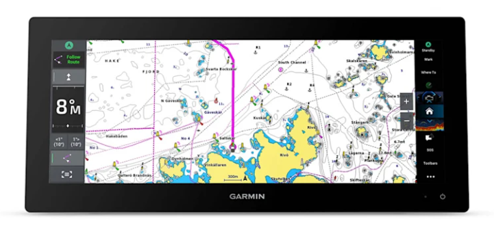
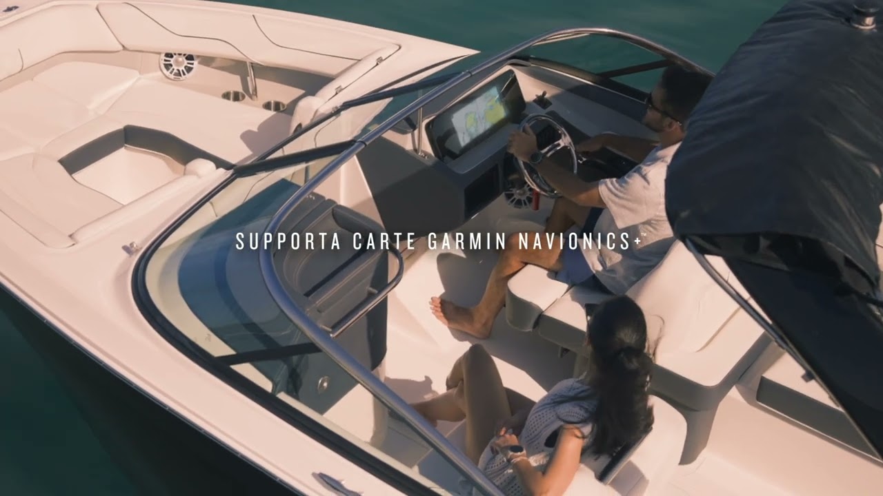
NAVIGATE SAFELY WITH SUPPORT FOR GARMIN NAVIONICS+ AND GARMIN NAVIONICS VISION+ MAPS

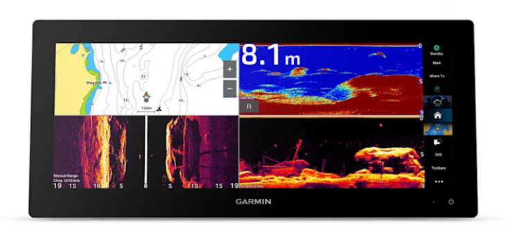
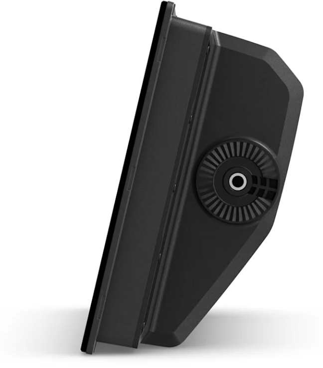
OBSERVE WHAT'S UNDER THE BOAT WITH THE INTEGRATED DEPTH SOUNDER MODULE

TO ENHANCE YOUR SAILING EXPERIENCE SPECIAL RACING FUNCTIONS HAVE BEEN INCLUDED
A panoramic view for a limitless experience
MODERN AND ELEGANT DESIGN
Featuring a stunning thin-bezel, edge-to-edge glass display, the GPSMAP 15x3 chartplotter features an ultrawide, high-resolution touchscreen interface with a host of easy-to-use features that take inspiration from our GPSMAP x3 series chartplotters.
CLEAR AND BRIGHT SCREENS
This stunning
ultrawide IPS display offers wider viewing angles, vivid colors, and ensures excellent readability in direct sunlight, even with polarized sunglasses.
FULLY CUSTOMIZABLE
Discover the benefits of split screen so you don't have to give up anything. This feature allows you to fit multiple screens on the same page, allowing you to organize your screen to your liking without sacrificing extraordinary clarity of data.
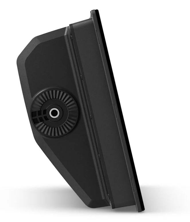
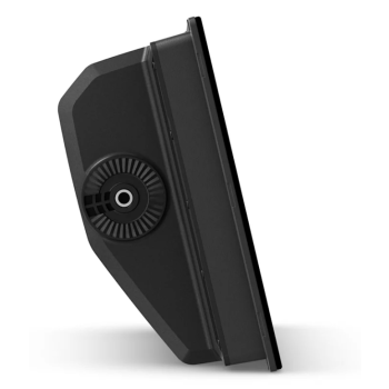
TWO MOUNTING OPTIONS
The mounting bracket allows for unique floating display installations (sold separately), while the flush mount option is designed for a flush installation.
Look at what's underneath your boat.
SUPPORT FOR TRADITIONAL AND SCANNING ECHO SOUNDER
Take full advantage of the built-in 1kW CHIRP traditional sonar module for excellent target marking. Plus,
ultra-high-definition ClearVü and SideVü scanning sonar provide vivid, high-contrast colors to distinguish markings from underwater structures (requires transducer, sold separately).
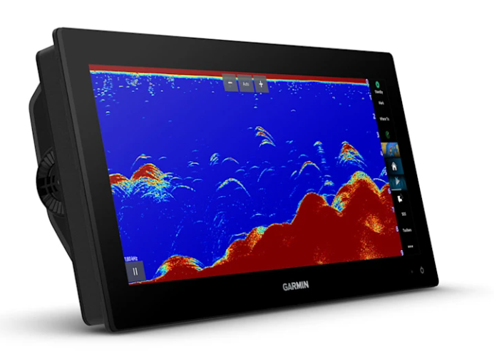
PANOPTIX TRANSDUCERS SUPPORT
Pair your plotter with
Panoptix or LiveScope sonar for easy-to-interpret sonar images (transducer required; sold separately), giving you a real-time view of what’s around your vessel.
Designed specifically for your dashboard
CARTOGRAPHY
Navigate with optional
Garmin Navionics+ charts featuring Auto Guidance+ technology, daily updates and more (subscription required).
PREMIUM CARTOGRAPHY
Sail and navigate with ease.
GARMIN SAILASSIST SAILING NAVIGATION FUNCTIONS
POLAR TABLES FOR SAILING
Use the
polar table function to view key data, including how fast to maintain at a given angle and wind speed, so you know if you need to adjust your sails.
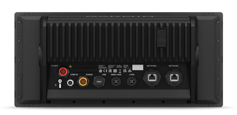
GARMIN MARINE NETWORK
If you have multiple compatible Garmin devices on your boat, you can
share information, including maps, user data, radar and IP camera video.
NMEA 2000 AND NMEA 0183 NETWORKS
Connect to compatible autopilots, digital switching, weather, Fusion Audio, media, VHF, AIS and more on a single screen.
ACTIVE CAPTAIN APP
Built-in Wi-Fi connectivity pairs with the free, all-in-one mobile app for access to the OneChart feature, smart notifications (when paired with your smartphone), software updates, Garmin QuickDraw community data and more.
INTEGRATED ANT TECHNOLOGY
Connect with some of your favorite devices, like quatix watches, gWind Wireless 2 transducers, GNX Wind instruments and wireless remotes.
CONNECTION TO THE ENGINE
ONEHELM FUNCTION
This feature brings together all operations and functionality of
EmpirBus and third-party digital switching devices on a single screen.
SENDING MESSAGES FROM INREACH DEVICES
Pair your inReach satellite communication device with your chartplotter and type custom messages using the chartplotter's on-screen keyboard. Access your address book or enter an email address, inReach address or phone number. Group messages by conversation for a more convenient messaging experience.
Integrates additional features for vessel control
POWER-POLE SHALLOW WATER ANCHOR
By connecting select GPSMAP 15x3 chartplotters with a Force trolling motor and compatible Power-Pole shallow water anchoring system, you can access advanced boat control features from your chartplotter, including automatic Smart Anchor Setup, Smart Anchor Shift, Auto-Anchor, Auto-Stow, Trailing Anchor Detection and End-of-Run Anchor. Spend more time fishing and less time positioning.
TROLLING MOTOR INTEGRATION