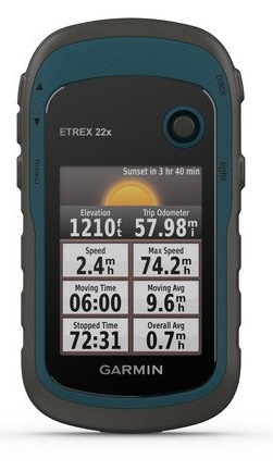
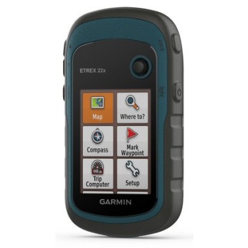
Garmin GPS eTrex 32x
Explore with confidence with a highly reliable portable GPS
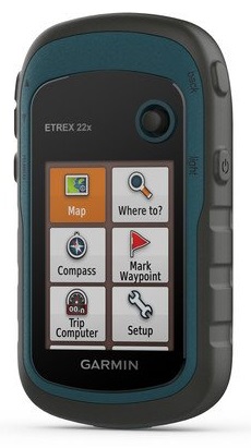
- 2.2 ”anti-glare color screen with a resolution of 240 x 320 pixels for better readability
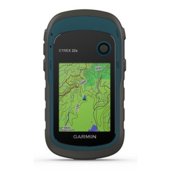
- It is preloaded with TopoActive Europe maps, which include cycling and walking roads and paths
- The support of GPS and GLONASS satellite systems allows detection in the most remote places and in an even more reliable way than just using GPS
- 8 GB of internal memory for map download and microSD ™ card slot
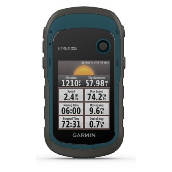
- The eTrex 32x model also offers a 3-axis compass and a barometric altimeter
- Battery Life: Up to 25 hours in GPS mode with 2 AA batteries
eTrex 22x and eTrex 32x offer the same intuitiveness, durability and convenience that eTrex handheld GPS devices are known for but with the addition of preloaded TopoActive Europe maps. They are ideal for quad biking, biking, boating and hiking activities.
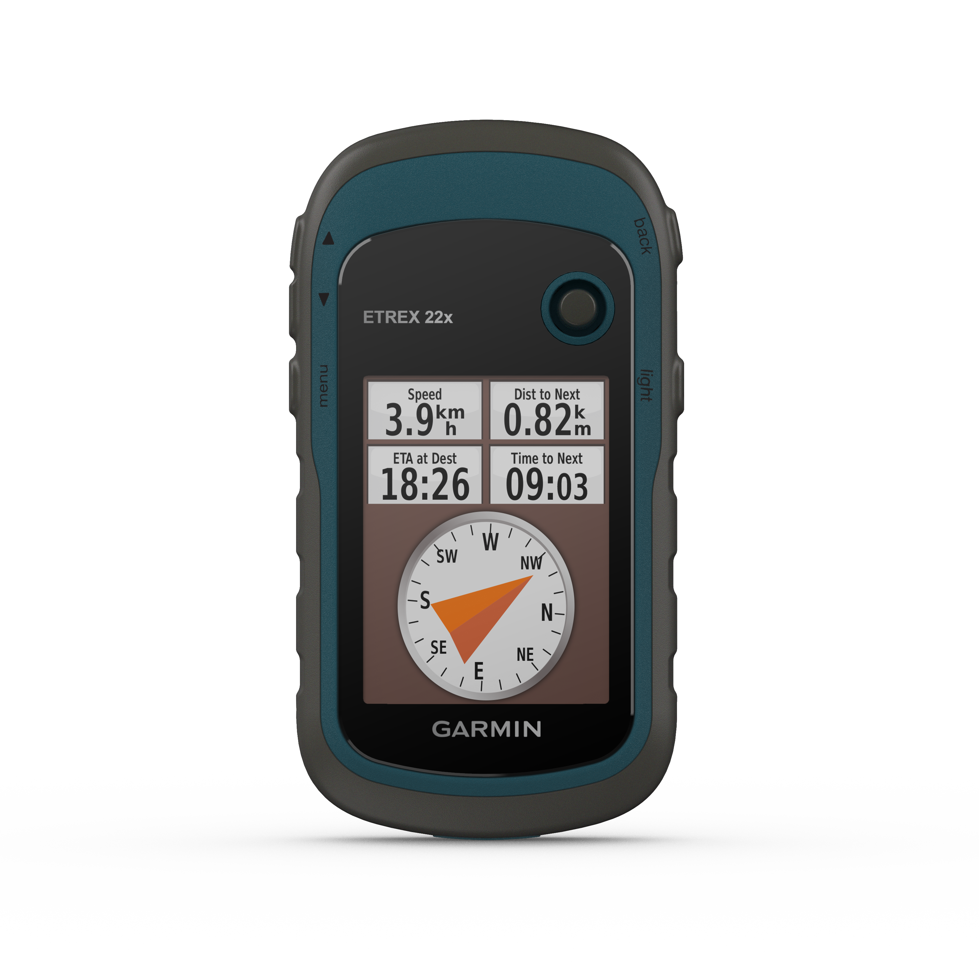
Maximum visibility
The eTrex 22x and 32x models feature a 2.2 "anti-glare 65K color screen. Tough and waterproof, these devices are designed to withstand extreme weather conditions.
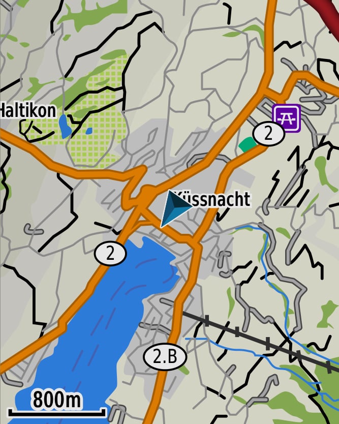
Exploration of the territory
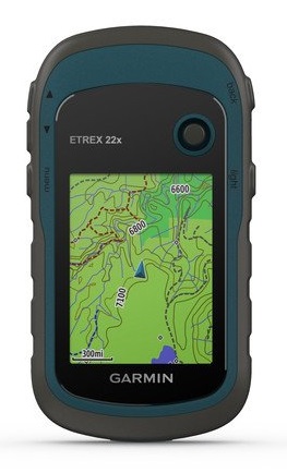
The eTrex 22x and 32x handheld devices are preloaded with TopoActive Europe maps that include straight-line roads and paths. This way you can discover your surroundings, such as waterways, nature trails, buildings, international borders and much more. Plus, you can find thousands of points of interest, including shops, restaurants, universities, car parks and accommodations.
Don't lose your position
The eTrex series uses the GPS and GLONASS satellite systems, therefore the integrated receiver is able to carry out surveys in the most remote places compared to GPS alone. The eTrex 32x model adds a 3-axis compass and a barometric altimeter to help maintain heading.
Additional maps
Thanks to the microSD card slot and 8GB expanded internal memory, you can easily download additional maps for any adventure.
Satellite imagery
Both devices support BirdsEye Satellite Imagery (subscription required) to download and integrate satellite imagery with maps.
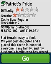
Fun guaranteed
eTrex 22x and eTrex 32x support electronic geocaching. Upload GPX files directly to your device and view important information, such as location, terrain, and Geocaching.com tips.
Unlimited explorations
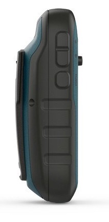
Thanks to a wide range of compatible mounts, the eTrex is designed to be a portable GPS device ideal for the outdoors, to be installed on quads, bikes or boats, but also for hiking. Use the automatic installation feature and City Navigator® NT maps for detailed driving directions, or the robust motorcycle or quad mount. Whatever destination you choose, eTrex is equipped with the maps and supports to reach it.