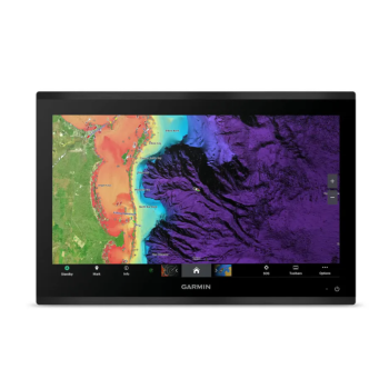
19" 4k color display
THE MAXIMUM OF DEFINITION IN 4K
Transform your dashboard into a wonderful crystal console with a modern and elegant look thanks to the edge-to-edge design.

HIGH QUALITY 4K IPS TOUCHSCREEN READABLE IN SUNLIGHT FROM ANY ANGLE

PROCESSING POWER UP TO 7 TIMES FASTER THAN PREVIOUS GENERATIONS

GIGABIT SPEED ON THE GARMIN BLUENET ™ NETWORK

VIDEO INTEGRATION WITH HDCP DISTRIBUTION

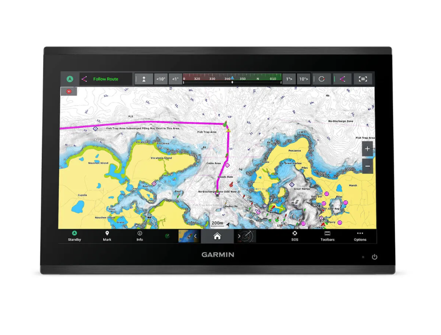
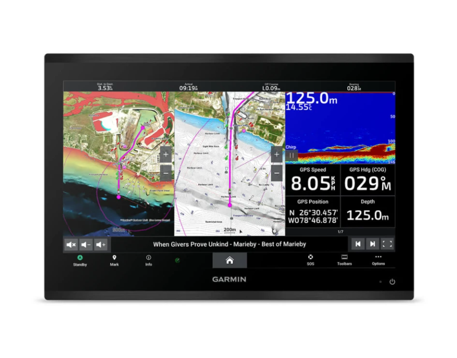
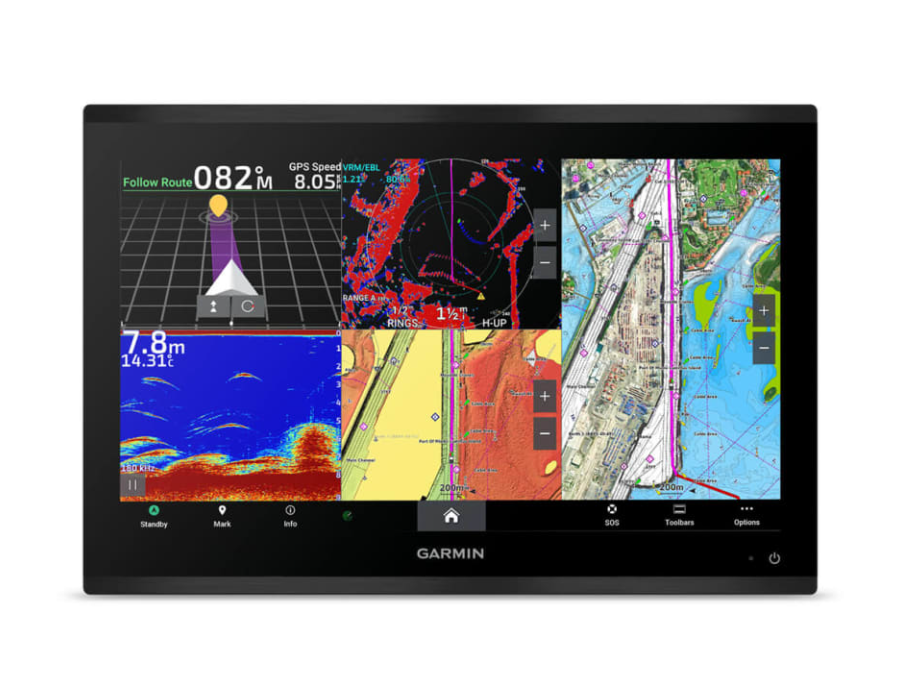
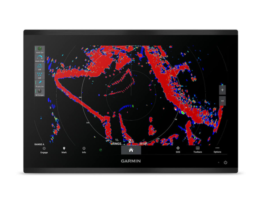
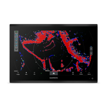
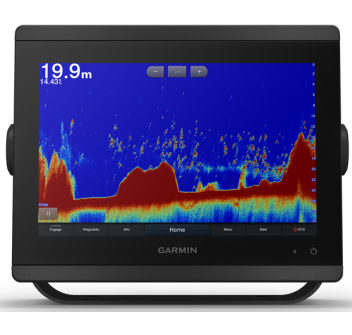
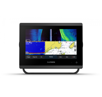
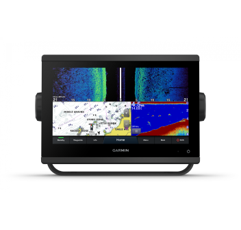
SEE YOUR SOUNDER TARGET LIKE NEVER BEFORE ON THE 4K SCREEN 1

POSSIBILITY TO ADD MORE CHARTPLOTTERS, CAMERAS AND DEPTH SOUNDERS ON THE NETWORK
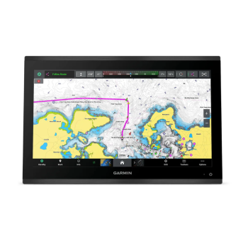
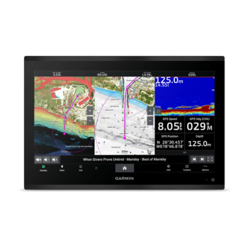
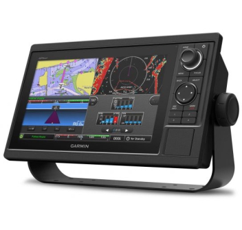
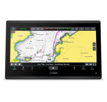
HIGH QUALITY GPSMAP 9019 CHARTPLOTTER
The sunlight-readable 4K IPS touchscreen is available in 19″, 22″, 24″ and 27″ sizes. The edge-to-edge design ensures a modern and elegant look.
EVEN FASTER
Processing power is 7x faster than previous generations for superior performance. View maps and calculate routes with Auto Guidance+™2 at supersonic speed with an optional Garmin Navionics+™ subscription.
GARMIN BLUENET NETWORK
Create large networks by adding chartplotters, cameras, radar and fish finders and get 10x faster speeds.
PERSONALIZED ENTERTAINMENT
Discover audio and video integrations that let you play and listen to the same video on all screens and speakers on your network.
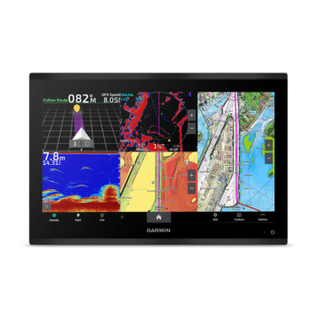
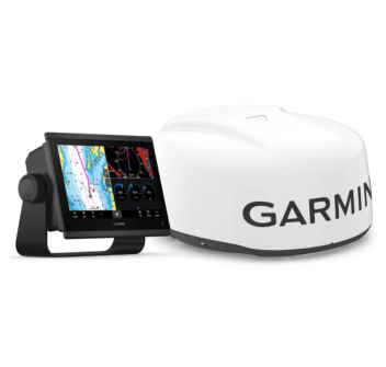
HIGH DEFINITION DEPTH SOUNDER
Fishing in high definition. Connect to one of our sonar modules and view targets on the 4K screen (transducers sold separately).
TOTAL CONNECTION
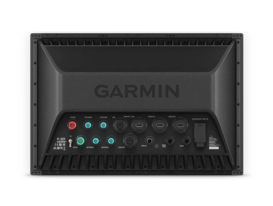
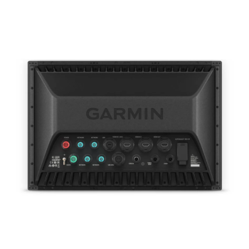
Take command by integrating digital systems to monitor, automate and control your vessel. The chartplotter uses NMEA 2000® and NMEA 0183 networks to connect to compatible accessories.
FUNCTIONS
Software updates
Get wireless software updates via the ActiveCaptain® app with a compatible smartphone or tablet.
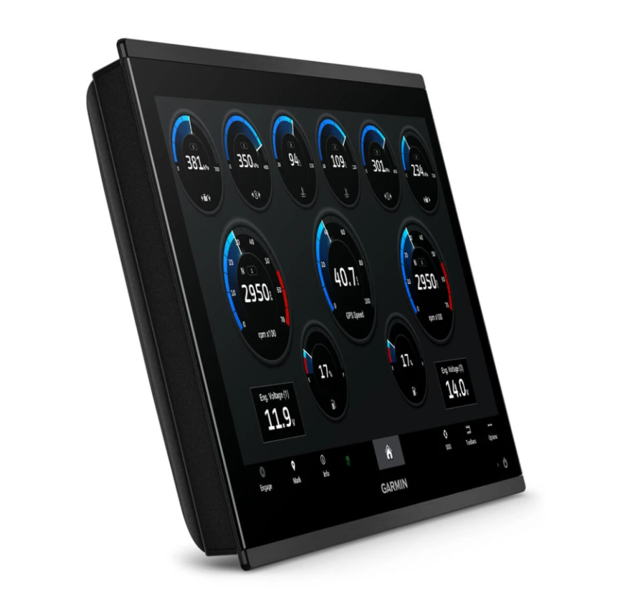
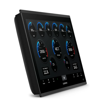
ENGINE MONITORING
Monitor engine performance.
PERSONALIZED LOOK
Builders can customize the homepage layout and launch image for maximum customization.
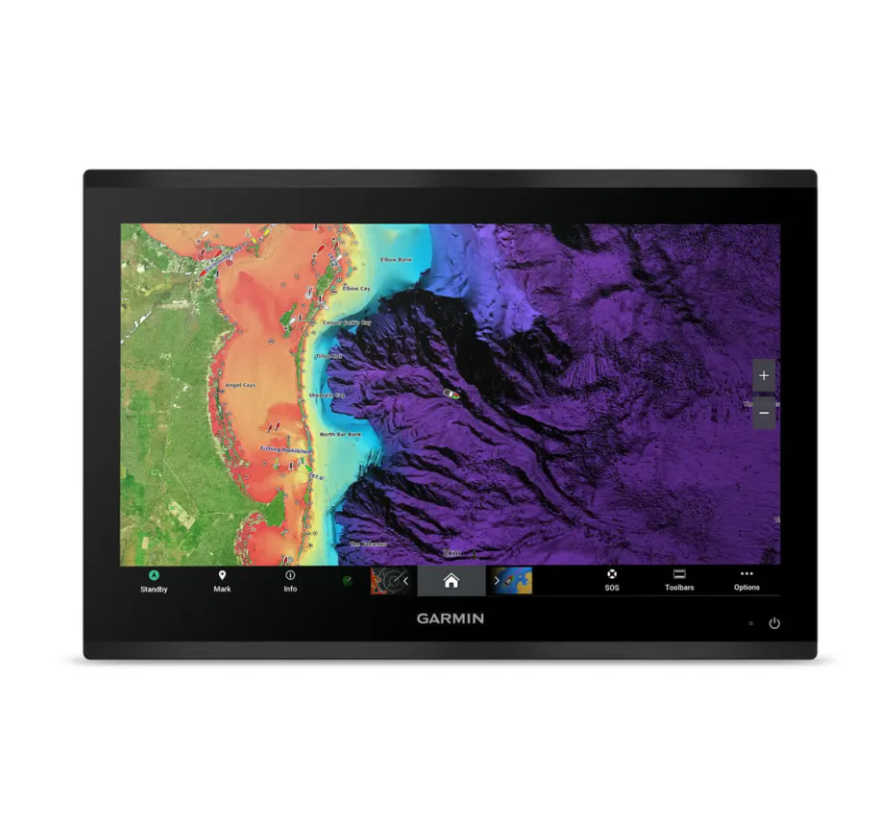
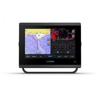
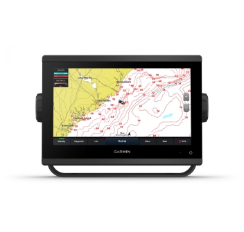
MAPS
Navigate with optional Garmin Navionics+™ charts that include Auto Guidance+ technology, daily updates and more2 (subscription required).
RELIABLE PREMIUM CARDS
Garmin Navionics Vision+™ chart support with relief shading and high-quality satellite imagery.
FIND OUT WHERE YOU ARE
Get precise location with the included 24xd GPS location receiver and antenna.
AUTOPILOT
Control the autopilot with any network-compatible chartplotter with autopilot integration.
CONNECT THE CAMERAS
Full camera support and control to view footage directly on the chartplotter.
SURROUND VIEW SYSTEM
Get a bird's-eye view with support from our Surround View Camera System (purchase of accessories required).
CONTROL VIA QUATIX
Connect to the chartplotter with your compatible Garmin smartwatch.
Wireless Connectivity:
Allows you to connect compatible devices via BLUETOOTH® or ANT® technology.
FISHING MAPS
Get comprehensive fishing data with SiriusXM® Radio's Fish Mapping™ feature (accessory purchase and subscription required).
VOICE COMMANDS
Use voice commands to control the chartplotter using a compatible headset.
RESISTANT TO THE MARINE ENVIRONMENT
The GPSMAP 9019 chartplotter is designed for harsh marine conditions with an IPX7 waterproof rating.
PACKAGING:
- GPSMAP 9019 Chartplotter
- Interlocking protection for dashboard finishing
- Protective cover
- Accessories for flush mounting
- Power cord
- GPS 24xd NMEA 2000 ® (with pole, flush and flush mount adapters)
- NMEA 2000 cable (2 metres)
- NMEA 2000 power cable
- T-connector and NMEA 2000 terminator kit
- Documentation